Garden map part 2
>> Saturday, February 11, 2012 –
map
Remember a couple of weeks ago when I started working on the map of my yard? My intent was -- and still is -- to create a scale map of my entire property, labeling all of the plants, structures, etc.

I've done a little more work on the map since then, and run into some trouble. Want to take a look?
I took a lot more measurements, and as a result I modified the driveway and walkway. Both of them were not drawn correctly on the survey -- at least not correctly enough for my purposes.
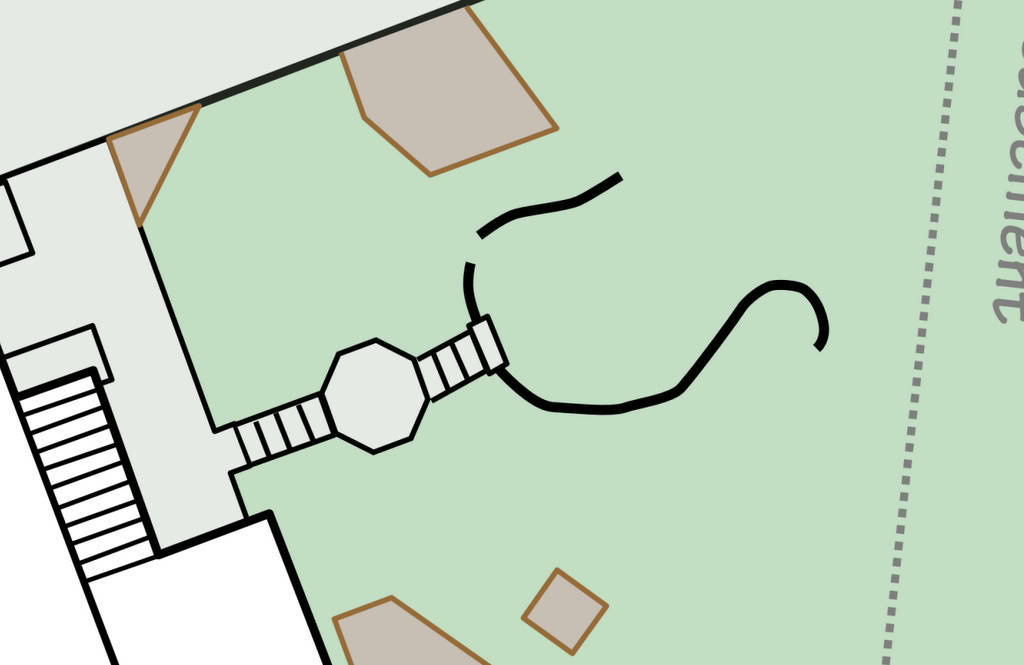
I decided that adding all of the raised planting beds to the map would be the next step. Since they're semi-permanent structures they'd work well as "anchor points" or landmarks to help me figure out what the bark parts of the yard look like mapped out. They're drawn in brown on the map.
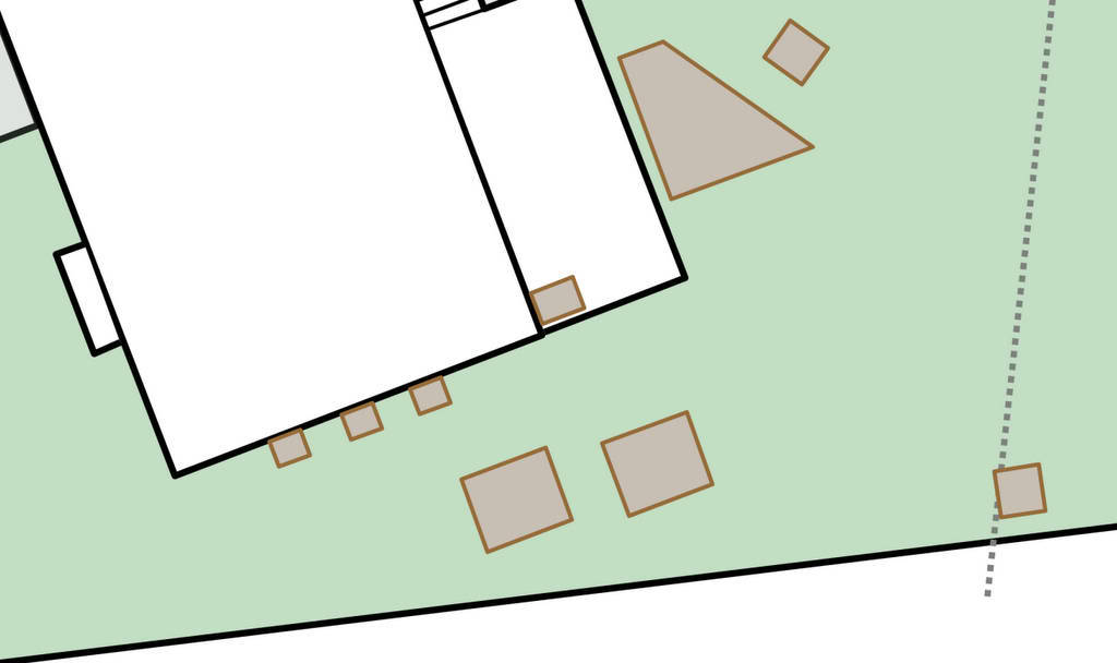
The boxes close to the house were simple enough to place. The ones further away, not so easy. I'll get to that in a minute. First though, another permanent structure: the patio.
The problem with the patio (and what makes it so interesting) is that it is not a regular shape. It's not square, or rectangular -- there isn't a single straight edge on it. It's not circular, or even elliptical. It's what you'd probably call "extremely organic".
I love it in the garden, but curse it on the map. So difficult to draw! What I have so far seems like a decent approximation, but I'm not sure if it's completely correct yet. It will take more measurements and the addition of more features (planting beds, trees) to tell if it needs to be changed.
Another problem: measurements aren't matching up with the survey map. This became obvious when I tried placing the pond:
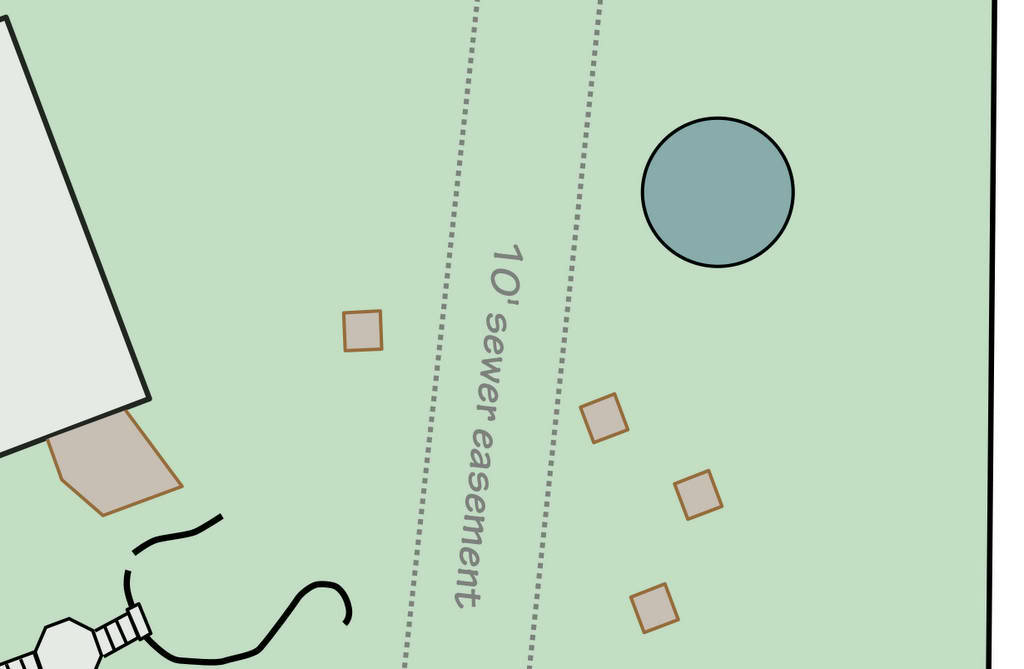
I measured from the corner of the driveway, and it put the pond overlapping the sewer easement, with a very large space between it and the back property line. I'm pretty sure that's not correct. I have a grid overlay of 1' squares that I'm using in the drawing to help me place things, and it's pretty accurate.
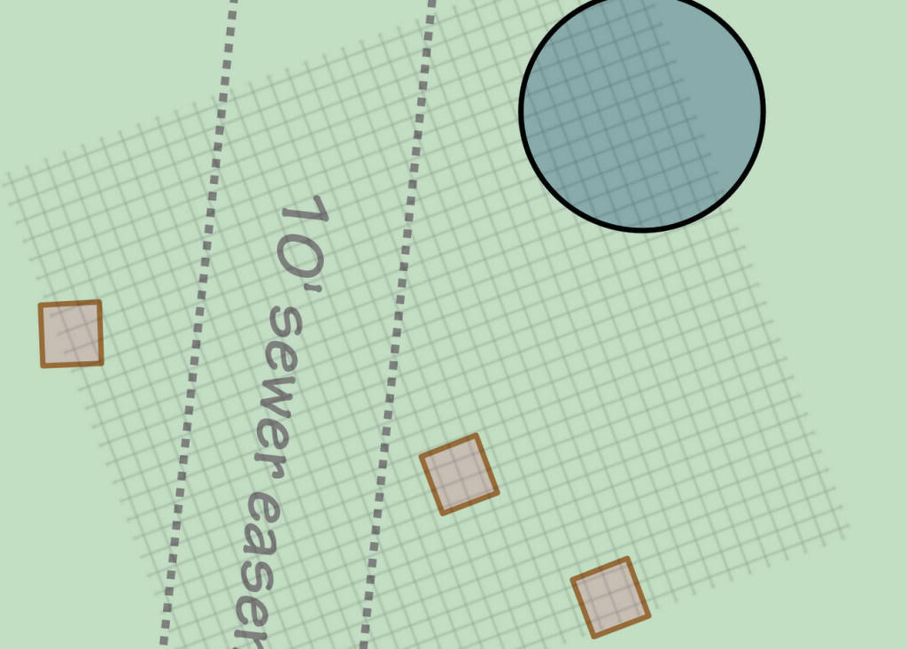
Without a fixed reference point it's really hard to locate these features -- these 3' square planter boxes are correct in relation to each other, but I'm not sure if the grouping of them is located accurately. They could be rotated incorrectly too. Lots of uncertainty.
So I had to fudge the placement of the pond, at least for now. I suspect I'll get a better idea of what's going on when I add some of the other features like the veggie garden fence, and some of the planting beds.
It's taking some work, but I'm making progress and am still really excited about this project!
.


Since you're doing this on a computer, it must be much easier to move features than redrawing them on paper which is how my maps are made. You might find it helpful to put a few stakes in the yard with string off of know correct points on your map and create some temporary lines in the garden that will help you place those odd shaped items. Even the patio should be able to be broken down to points it reaches and they you draw in the curves between the points. Good luck!!!
Great idea on using stakes! Thanks for the tip.
Very cool thing to do!
I think this is a great idea, unfortunately no good for my muddled up brain, where everything seems in an orderly fashion. Well the truth becomes more clear on closer inspection.