Getting started on the map of the yard
I've mentioned that I've been wanting to create a highly-detailed map of my yard for some time. I did some experiments with a camera on a long pole, and recently posted several labeled photos of my plants in preparation for the map.

I've finally started working on it, so here's the first part of the process. The whole procedure will take several weeks I'm sure, but I'm getting excited about it now.
I decided to give up on starting with photos of the yard from above, like a high-resolution satellite view. I just didn't see a good way to accomplish this that didn't either cost money, put my camera at risk, or involve lots of photo manipulation afterwards.
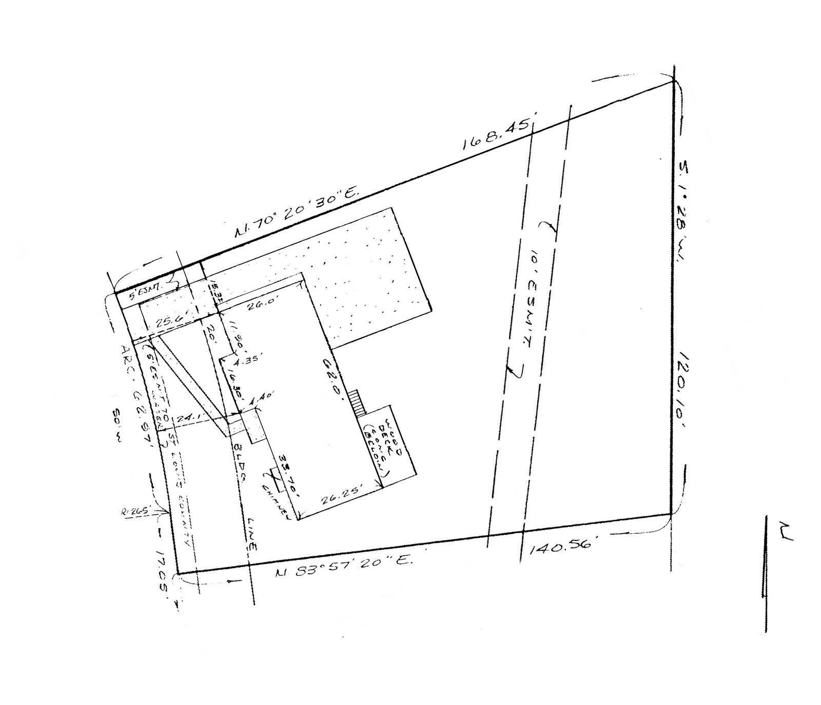
Instead, I went low-tech in a way, and started by scanning the surveyor's map of my yard. It is a scale drawing (meaning that everything on it is in proportion), and it contains all measurements that I'll need. Well, almost all, as I'll get to in a minute.
So I scanned the document (which was from a 20-year-old fax), and cleaned it up a little:
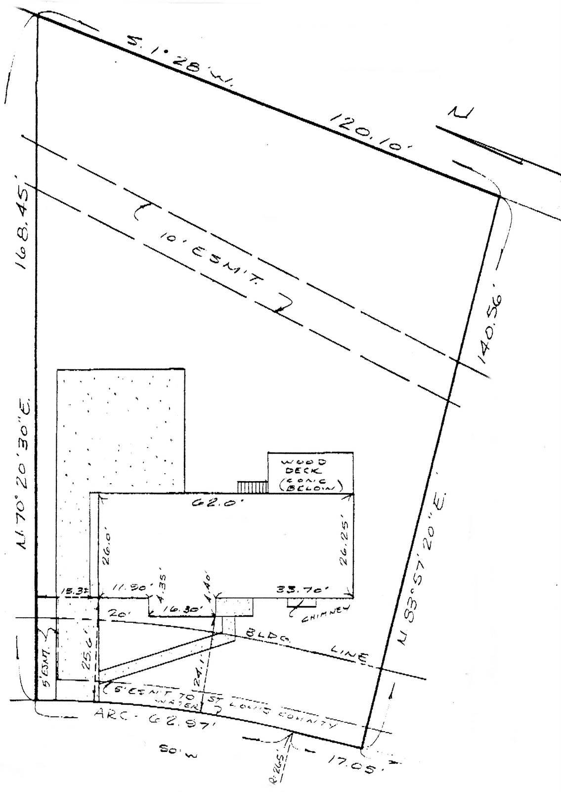
Okay, the first thing I need to do is figure out what's missing from this drawing. You see, the front of my property actually ends before the sidewalk, and the city (or county) technically owns the land between that point and the street.
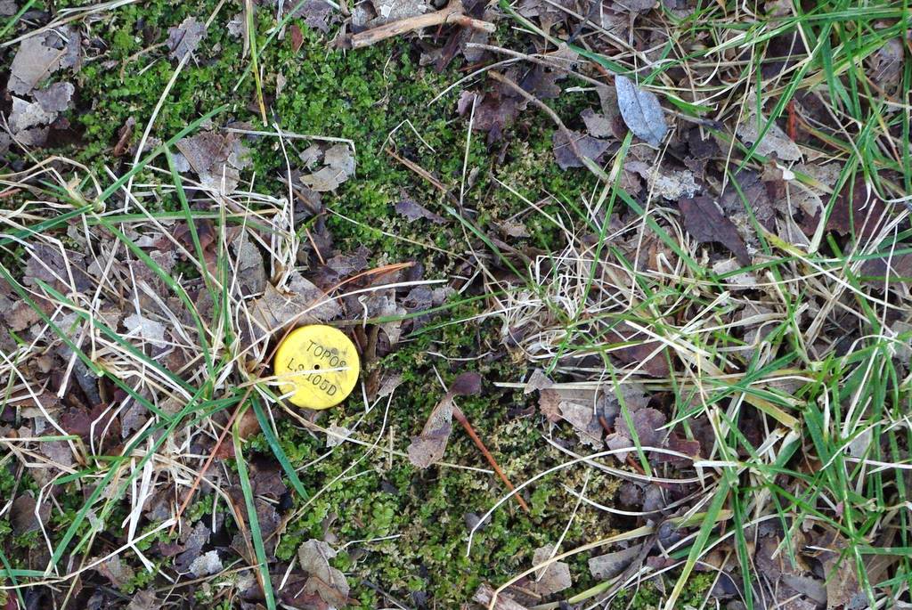
Here's the marker for the corner of my property:
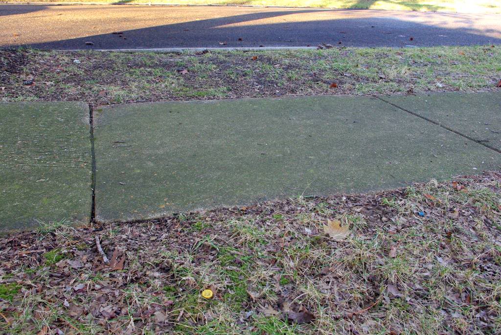
It's several feet from the street:
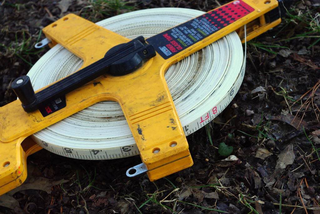
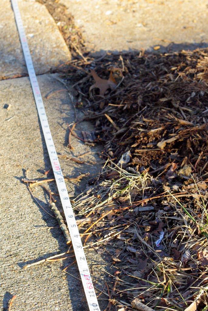
So time to get out the loooooong tape measure:
And find out how far the street is from the property marker. Although we don't own that property, we're allowed to treat it as part of our yard and are therefore required to maintain it. In other words, I can plant stuff here -- which means it needs to be part of the map.
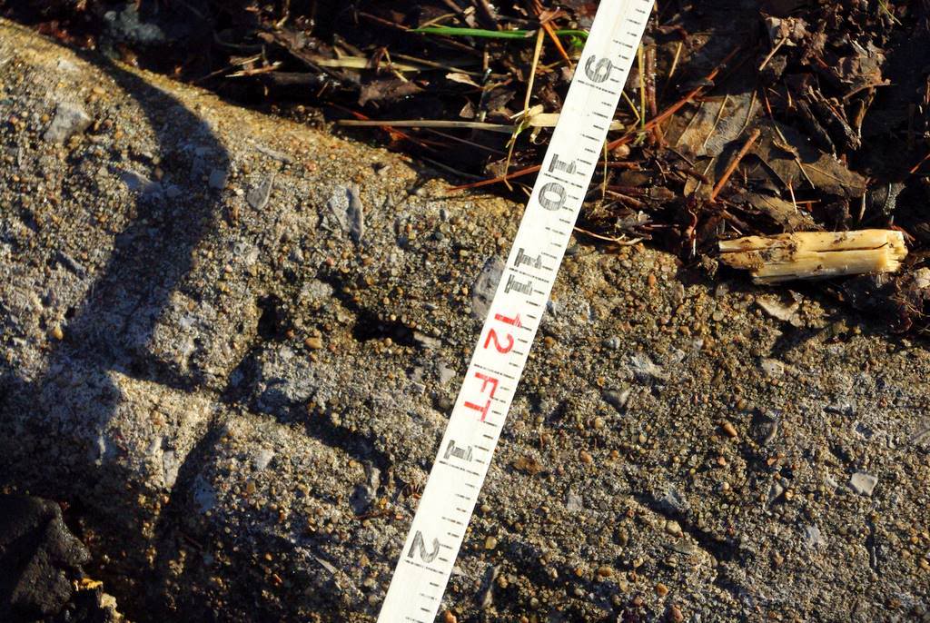
So, it looks like about 12' (3.6m). You can also see the little marker they put into the curb to help indicate where the property lines are located. Much more permanent and usually easier to find than a 40-year-old metal post that may be buried several inches below ground now.
Here's approximately where my property line is in front:
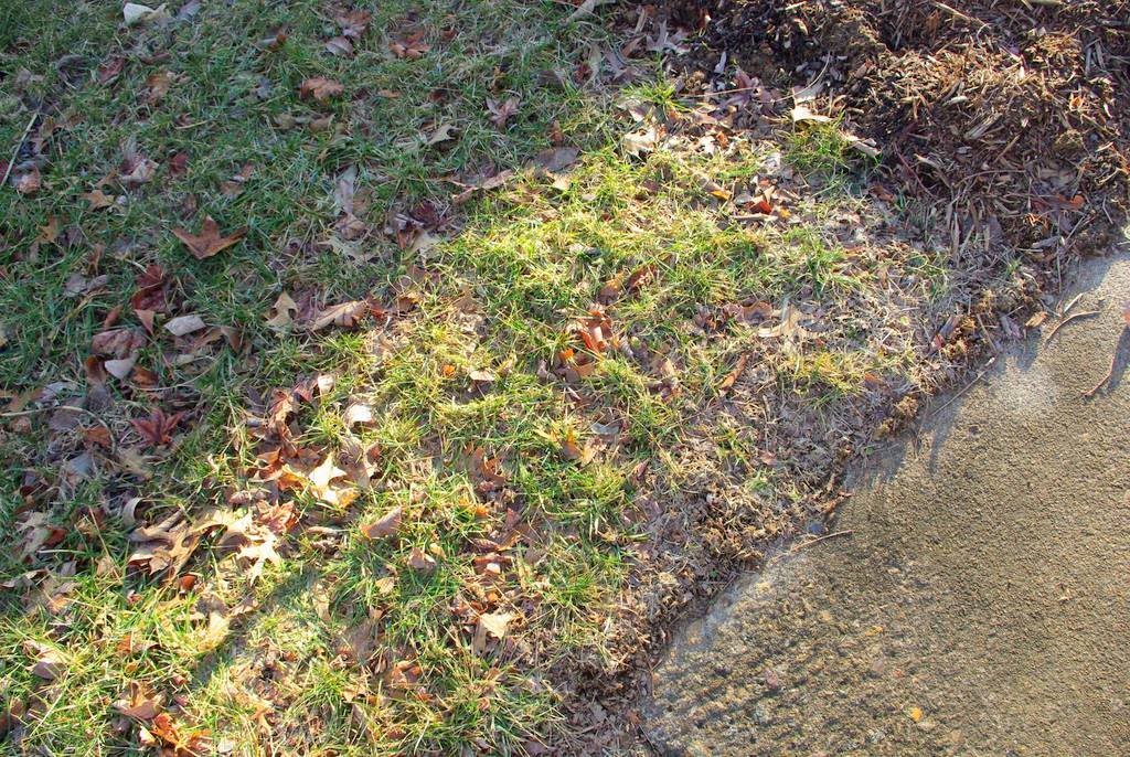
I should point out that the south side of my yard (the above photo looks south) has newer markers because my neighbor on that side moved in just a few years ago and the surveyors put in new markers. The other side of my yard though (where I'm standing when taking that above photo)... well, those markers are nowhere to be found:
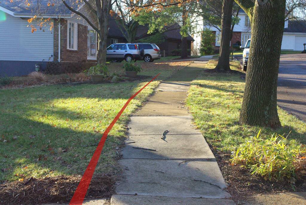
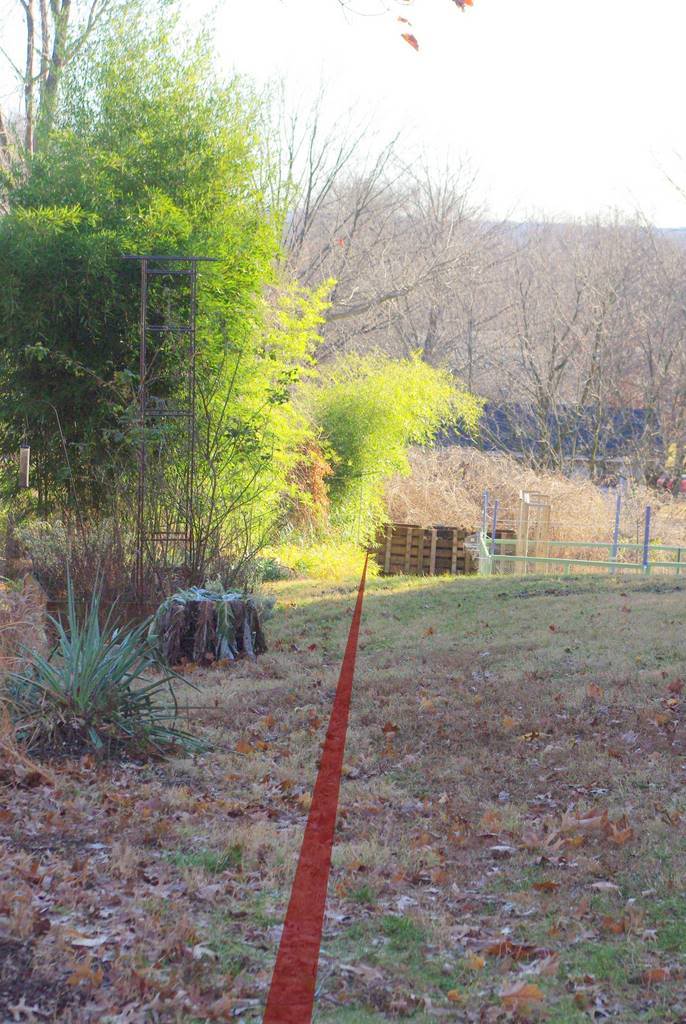
Looking at the map to get the distance across the front of the yard, I can use the tape measure and determine where the other corner is (close enough for my use) using the existing marker:
 |
| South is on the right, north on the left. |
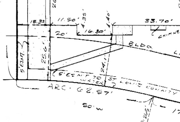
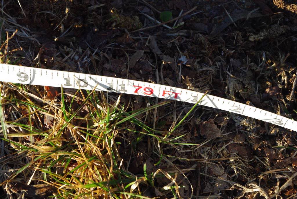
The front property line is curved, with a radius of 265'. That's a large radius that I'll never be able to duplicate exactly so I'll just follow the curve of the sidewalk with the tape measure as an approximation. From the drawing it looks like 62.97' -- 63' in practice.
Unfortunately, that doesn't work:
As you may be able to see (63' is at the bottom of the image), that's not nearly far enough -- as it is doesn't even get to the driveway let alone across it. It looks like it needs to be about 79' or so:
So, what's going on?
Ah, I misread the drawing. The arced part of the property line is 62.97' long, but there is an additional straight portion that is 17.05' long (scroll back up to see the original drawing). Add those together and you get 80.02' -- I'm calling it 80', which agrees with the tape measure. This is the approximate property line along that side:

I'll have to check exactly where it is, but that little utility box on the ground is for cable TV, and the property line goes right through it I think. The trees are on my side of the line, although there's most likely not more than a foot or so of additional room between them and the line.
Incidentally, the property line on the south side of the yard (with the visible markers) looks like this:
I've shown that view to you several times before, as that's where I need to do my most diligent rhizome pruning to keep those bamboos from spreading into my neighbor's yard.
So now that I know how much additional front yard space there is past the property line (12' remember), I can work on my map.
I won't go through every step of the process, but I wanted to get a clean, vector-based drawing of the property lines, house, driveway, etc. instead of the ugly scanned image. I also wanted my map to be based on compass headings (with North pointing up) instead of based upon the house. So first I rotated the scanned drawing so North pointed up:
Then I just started tracing everything, putting it into appropriate layers: house, dimensions, driveway, easements, etc. I was using Paintshop Pro, but any paint app that can create vector layers would work. (A vector image is resolution-independent, so you can zoom in as much as you want and the edges of everything look sharp, not blocky as they would with a bitmapped image.) I created different layers so I'll be able to turn off the measurements, or the easements if I want to. I'll do the same once I start drawing the different planting beds, maybe organize them by families (grasses on one layer, bamboos on their own layer, flowering perennials on another, etc.) so I can focus on different layers if I want to.
Anyway, after a bit of tracing and adjustment, I have my basic bare yard map ready:

It's not 100% finished as I need to figure out where the sidewalk goes, and I have a feeling the driveway dimensions are not accurate, but I'll do that, update the map, then start adding garden features: the patio, pond, planting boxes, etc. Then come the plants...
This is going to be fun!
.


Goodness! This is serious stuff!
P.S. You'll need to change the name of your blog to 'It's not gardening, it's work!'!
That is going to be a great resource.
I echo what Lucy said: "It's not gardening, it's work!" Hats off to you, this is not something I could ever do. But the result will be so worthwhile. Anytime you want a vacation in Northern California, you can stay here and do the same for our property :-).
I've tried doing something similar - and am highly impressed by what you have done - because mine looks nothing like yours!! I abandoned my "map the garden project" because I found it too hard to do on the computer and my hand drawings look too messy - I'm still trying though, but doubt I'll ever get them show-worthy. Looking forward to seeing the next installment of yours and what you do!